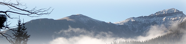
 | Arizona Printed Statewide Map. |
Printed Statewide Unit Map for Arizona displaying all unit boundaries. 36" by 36"
|
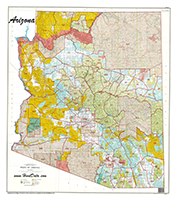
 | Arizona Printed Land Ownership Map. |
A completely updated set of land ownership maps with updated roads and trails from the USGS Quad set and added water tank details.
|
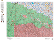
 | Arizona Mule Deer Concentration. |
1:100,000 Arizona Unit Maps highlighting High, Medium, and Low concentration areas for Mule Deer.
|
 | Arizona Elk Concentration Unit Maps. |
1:000,000 Arizona Unit Maps highlighting High, Medium, and Low concentration areas for Elk.
|
 | Arizona Antelope Concentration Maps. |
1:000,000 Arizona Unit Maps highlighting High, Medium, and Low concentration areas for Antelope.
|
 | Arizona Bighorn Sheep Concentration Maps. |
Base Topo Map with Bighorn Sheep High, Medium, and Low Concentration Areas.
|
 | Arizona Turkey Concentration Unit Maps. |
1:100,000 Arizona Unit Maps highlighting game management unit boundary along with Gould Wild Turkey Concentrations and Merriam's Wild Turkey Concentrations.
|
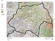 | Arizona Unit Topographical map. |
1:000,000 Unit Maps with highlighted Unit Boundaries, Major Roads and Trails.
|
 | Arizona Centerpoint - the most detailed hunting map available. |
The most detailed custom map available. Give us you coordinates, a favorite mountain top, valley, or other location and we'll build the most detailed map available (7.5 minute) around your "Centerpoint". We can add concentration date, unit boundaries, private land shading covering an 8 by 10 mile area.
|
Arizona Statewide Digital Map Set. |
Our popular Statewide Digital Map Sets for Arizona! The maps are ready for use on your computer in 3D, in your iPhone, or DROID and in new Garmine Units with 'Custom Maps' Capability! The map sets contain a Land Ownership Map, USGS Topographic Map, and Concentration Maps for Deer, Elk, and Antelope.
|