|
HuntData LLC
For Sales please Call.
303.663.4878
For support questions, please send us an email
the response will be much faster.

|
|
| |
| |
 |
| |
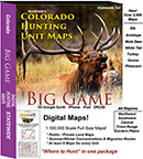
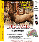
DIGITAL 1/100,000 MAPS -- HuntData's map set that works
with with Google Earth (see below), iPhones, iPads, DROIDs,
new Garmin Units and BigGameCD 7.0.
Colorado, Wyoming, Arizona and Utah Sets

|
|
|
Our Digital Map packages are collections of maps in industry standard formats. The maps can be viewed in Google Earth and on the devices listed. The maps are stored in an industry standard format call "geo-tiffs". These geo tiffs are actual map images with embedded coordinates. Most modern mapping software can load and recognize a geo-tiff. For Google Earth and Garmin users with "Custom Maps" capabilities, we also store them in the .kmz format. The Statewide Map set is a collection of 3 maps for every unit in Colorado, Arizona, or Wyoming..
Below are examples of the use of our 3D maps in Google Earth.
Imagine moving around your hunting unit like you were in
a helicopter, gliding up and down valleys, over ridges,
and up to the top of the highest peak in your unit.
HuntData’s Digital Maps allow you to let
your imagination, and scouting skills, run wild!
Google Earth's user-friendly interface makes viewing
HuntData's maps easy. The iPhone and iPad maps will bring a smile to your face. And, using them in the Garmin adds a new dimension to your hunting arsenal.
Generate realistic landscapes of
your unit using color satellite images from Google Earth, then make our hunting maps transparent to uncover new intel about your unit. Move up and
around in your unit inside clearly marked GMU boundary
lines. Get a visual image of where public and private
lands start and end from BLM Land Ownership map models.
Layers maps and fade them in and out to see the Google
Earth Satellites draped with HuntData's BLM maps and/or
Elk Concentration maps. You can also create your
own custom concentration maps from
BigGamdCD 7.0 and display them in Google Earth.
(internet connection required for Google Earth)
|
The 1,100/000 maps can be viewed in Google Earth (Windows or Mac), PDF Maps APP (iphone & droid)
or in BigGameCD 7.0.
- Topo
- Land Use
- Elk Concentrations
- Deer Concentrations
- Antelope Concentrations
- NASA
Satellite
|
|
There are 6 USGS maps per unit with clearly marked GMU
boundaries
Click on the image below for a fly-over video. The video shows a 3D Topo Map with projected summer and winter concentration areas. The red lines are the summer concentration, the blue lines winter concentrations.
|
A 1:100,000 BLM Land Ownership Map Screenshot is attached below.
On the map, the gold or orange areas are BLM, the green national forest and the white is private land.
|
 |
|
|
 |
|
 |
Click above for video - LARGE! |
 |
|
The maps can also be viewed in many
commercial mapping packages (GEO-TIFF format) and 3D
modeling software such as 3DEM (digital elevation models
included).
System Requirements:
Digital Maps (viewed in Google Earth)
Windows XP, 7.0, 8.1, 10, Mac iOS, iPhone, Droid
|
|
|
|
 |
|
|
|
|
| |
home |
about us |
products | search | checkout
| e-mail
| privacy policy
HuntData Copyright 1996-2017 HuntData LLC.
|
|
|
|